Dallas Weather: Understand the Flash Flood Warnings this Christmas Eve
Current Dallas Weather Conditions
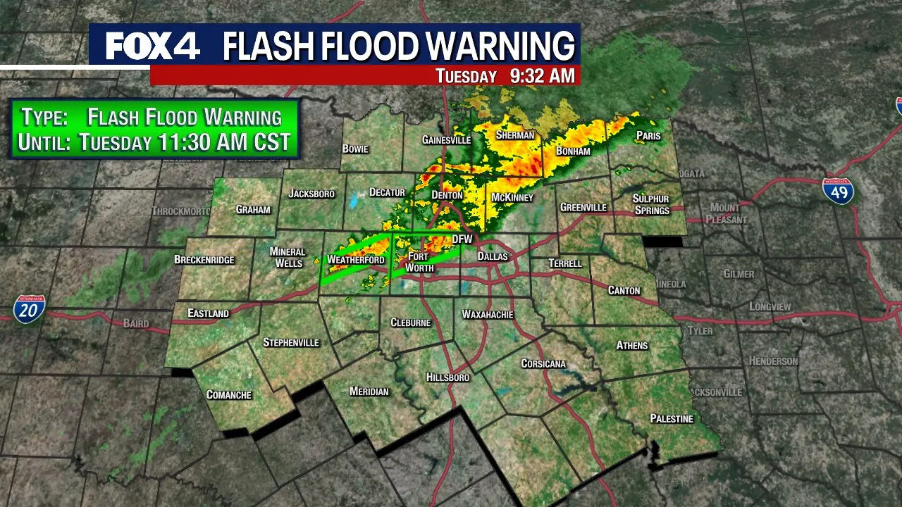
Some parts of North Texas are seeing heavy rain on Christmas Eve. A Flash Flood Warning was issued for northern Tarrant County until 11:30 a.m. and for parts of Parker County until noon. Radar estimates show more than 1.5 inches of rain has already fallen in some areas this morning.
Storm Developments
Tuesday's storms will ramp up quickly in the morning with expanding rain and some storms. That means some heavier rain will be possible in the strongest storms. By the afternoon, the heaviest rain will line up from the Metroplex east and south as the cold front drops down. The worst case scenario is some small hail and gusty winds, along with a flood risk. Overall, the severe weather risk is low.
Christmas Day Forecast
We will wake up to relatively mild temperatures on Christmas morning, near 50 degrees, but clammy with high humidity and clouds. It may be hard to break that cloud cover as we get an inversion layer in the afternoon, keeping temperatures cool in the 50s.
Upcoming Weather Patterns
The next strong system heads in on Thursday, bringing a rotating pocket of cold air with strong lift.
- Strong storms expected in the morning to midday hours
- Hailstones may reach quarter-size
- Gusty winds over 50 miles per hour
There is another disturbance headed in on Friday, but moisture will be limited. Temperatures are expected to return to the mid 60s under partly sunny skies with some lower shower chances.
By the weekend, Pacific air returns, with temperatures potentially climbing into the 70s by Sunday and Monday.
This article was prepared using information from open sources in accordance with the principles of Ethical Policy. The editorial team is not responsible for absolute accuracy, as it relies on data from the sources referenced.