Hurricane Tracker: Helene's Path towards the U.S. Landfall
Hurricane Tracker: Helene Approaching Landfall
MYRTLE BEACH, S.C. (WBTW) -- The latest from the National Hurricane Center indicates the center of soon-to-be Helene has formed in the northern Caribbean.
Current Position of the Storm
- Designated as Invest-97L, currently off the east coast of Honduras.
- Projected path to turn northwest between the Yucatan Peninsula and Cuba in the next 72 hours.
Forecast and Potential Impact
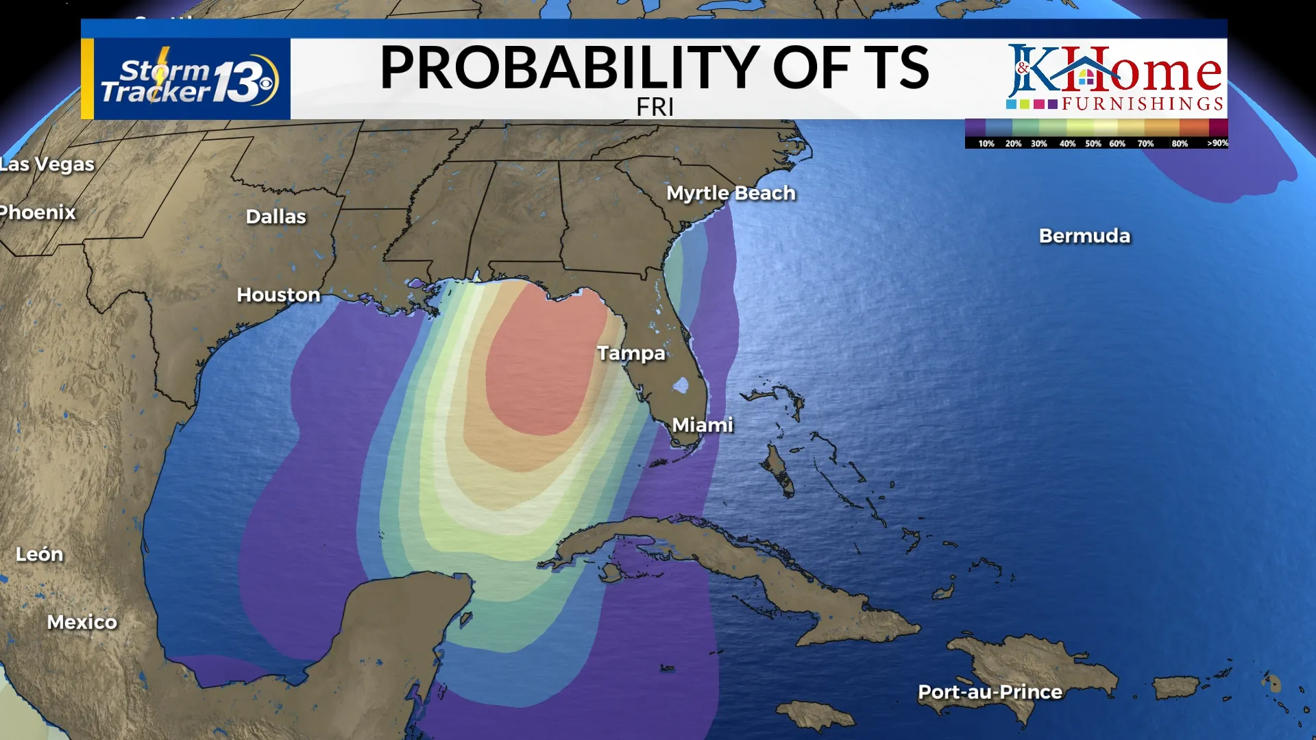
Rapid intensification is anticipated due to warm waters and low shear conditions in the Gulf of Mexico. While models show some divergence, consensus suggests a U.S. landfall, likely near Panama City or Tallahassee. Landfall is expected between Thursday afternoon and Friday morning.
Intensity Variations
- GFS model predicts significant intensification, shifting from a tropical storm to a major hurricane within 48 hours.
- Canadian model estimates landfall as a Category 1 hurricane.
Preparation for Residents
As this storm approaches rapidly, precautionary measures are advisable. The quick movement of the storm raises the possibility of spin-up tornadoes on Thursday and Friday, with projected rainfall amounts of 1-3 inches.
This article was prepared using information from open sources in accordance with the principles of Ethical Policy. The editorial team is not responsible for absolute accuracy, as it relies on data from the sources referenced.