Denver Weather: High Fire Danger Alert and Hazy Skies Ahead
High Fire Danger in Denver
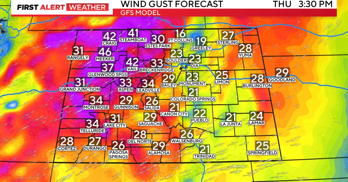
We have declared today a First Alert Weather Day for high fire danger from the Denver metro area out over Colorado's Eastern Plains and for portions of the mountains and Colorado's Western Slope. With the combination of gusty southerly winds and low relative humidity, a Red Flag Warning is in effect from noon today until 8 p.m. this evening. With the warm, windy and dry conditions, residents should avoid any burning or outdoor activities that may cause a spark.
Record Highs and Hazy Skies
Today, daytime high temperatures will climb to near record levels. With a forecast high of 91 degrees in Denver, we will be just a few degrees shy of the 94-degree record set back in 1911. Skies will also be hazy due to smoke from out-of-state wildfires. The Front Range air quality and visibility are forecast to be moderate throughout the day.
Upcoming Weather Changes
Conditions are expected to improve by Friday afternoon. Cooler temperatures will arrive for the end of the week, thanks to a dry cold front that will come through tonight. Daytime high temperatures will drop into the low 80s, close to the average high temperature for this time of year of 81 degrees. Looking ahead to the weekend, temperatures will warm up into the mid-80s with mostly sunny conditions.
This article was prepared using information from open sources in accordance with the principles of Ethical Policy. The editorial team is not responsible for absolute accuracy, as it relies on data from the sources referenced.